Description
Founded in 2016, ALEEGO is a drone services company which enable companies to digitize their assets and turn aerial data into business intelligence.
ALEEGO works with enterprise from various field such as agriculture, oil and gas, power utility and other industries throughout Europe - collecting, processing and extracting real value out of aerial data to improve productivity, operational efficiency, and worker safety.
Competences and capabilities
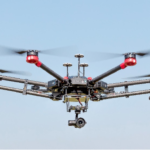
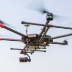
ALEEGO online platform count 70 drone pilots onboarded across Europe. The drone pilots registered on ALEEGO platform are qualified by the Operation Manager ensuring permits, equipment, insurance and capabilities are suitable for the customer depending on the mission.
Agriculture and forestry:
- Identify weather or wildlife damages
- Plant health using multispectral camera
- Treatment with biological solutions by drone
Civil Work:
- Quarries stock survey
- Project progress monitoring
- Inspection to ensure infrastructure safety.
Energy:
- Quickly locate area of improvement
- Increase safety of employees and assets reliability
- Locate point of failure using thermal analysis
Industrial inspection:
- Create 3D models
- Increase safety of assets
- Plan maintenance process
Renewables:
- Inspection of wind and solar farms
- Detect defective photovoltaic cells and/or wind turbines
- Support the construction phase
Operations:
- Request flight authorization to Civil Aviation Authorities (CAA)
- Ensure secured flight operation by setting flight procedures
- Securing data on cloud storage using blockchain
Major Space Projects & References
ESA Kick-start project – Blockchain was implemented onto ALEEGO platform to secure confidential data from our customers and to ensure the ability to submit indisputable original mission documentation.
ESA Demonstration project – Locate defects or area of improvement on network of pipeline or powerline for Energy companies using Artificial Intelligence.
Space Related Equipment, Labs & Certificates
- GPS tracking device ideal for tracking of assets/vehicles: GSM connectivity, A-GPS sensor
- RTK ground station to improve GPS accuracy